 |
Today a huge number of satellite imagery and geospatial data gathered from various sources is obtained free of cost. Satellite imagery merged with the power of Geographic Information System (GIS) can be the best tool for helping environmental management, disaster risk management, global climate change, natural resources, wildlife, land cover, and many more applications. Processing this huge amount of data during time and space efficiently and deriving useful information and knowledge from data is one of the most challenging aspects of geospatial technology. The course starts from January 18-29, 2021.
The curriculum of this course
- Overview of Geographic Information System (GIS) and different geospatial data types
- Overview of Python programming using Anaconda and Jupyter Notebook
- Introduction and overview of an Anaconda and Jupyter notebook
- Raster data processing, resampling, and analysis
- Vector data processing and analysis
- Geo-spatial data visualization on web
- Familiarization with various open-source geospatial data processing libraries e.g. GDAL, Geopandas, etc.
What you learn from this course?
At the end of this course, participants must be able to
- Participants easily write a program in python to read, write, and process different raster formats.
- Participants easily write a program in python to read, write, and process different vector formats.
- Participants easily write a program to visualize geospatial data in the form of maps, images, etc.
Who can apply for this course?
The candidates who want to participate in the course that is scheduled from January 18-29, 2021. The participants must fulfill the eligibility criteria. The candidate should be a student of the final year UG or PG course (any year). For more info check out the course notification form on the official IIRS website.
Course Fee
The IIRS institute provides this course free of cost and there is no course fee for attending this programme.
How to Apply for this course?
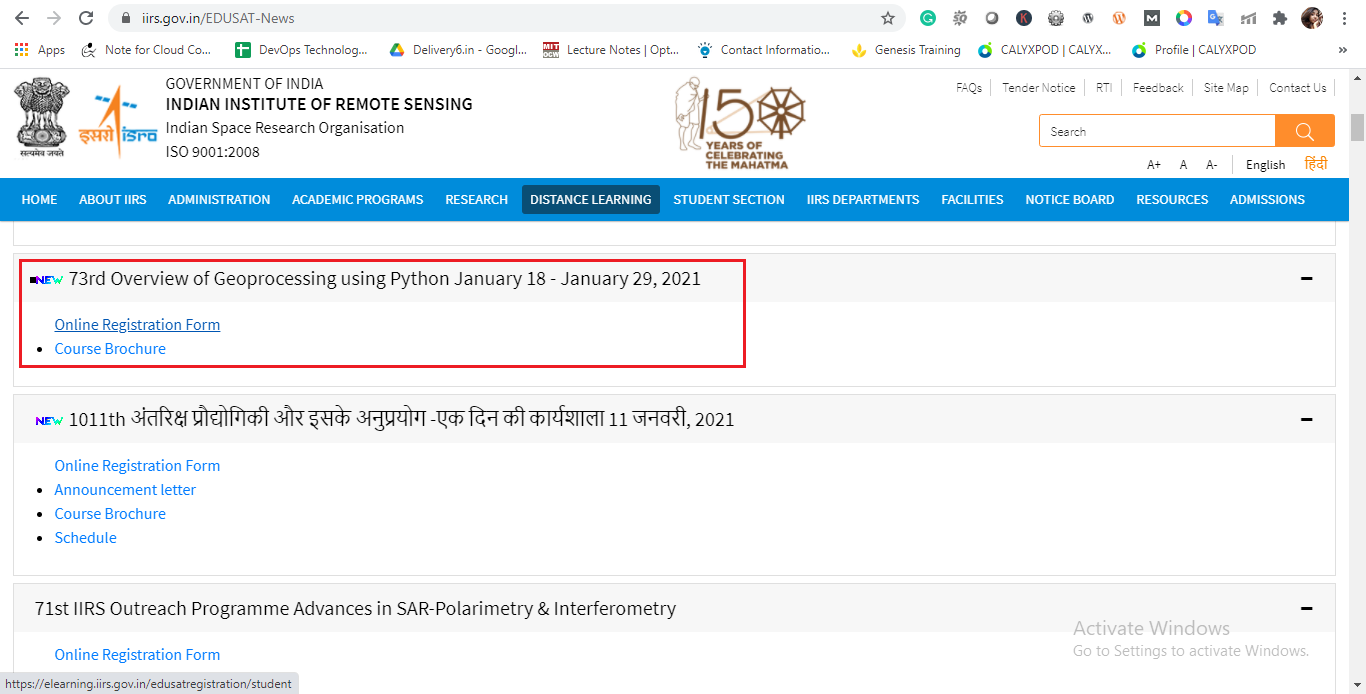
The course update and other valuable information you will get from the official website of IIRS https://www.iirs.gov.in/EDUSAT-News
Step 1:
Interested participants first register themselves for this course through an online registration link available under the course notification.
Step 2:
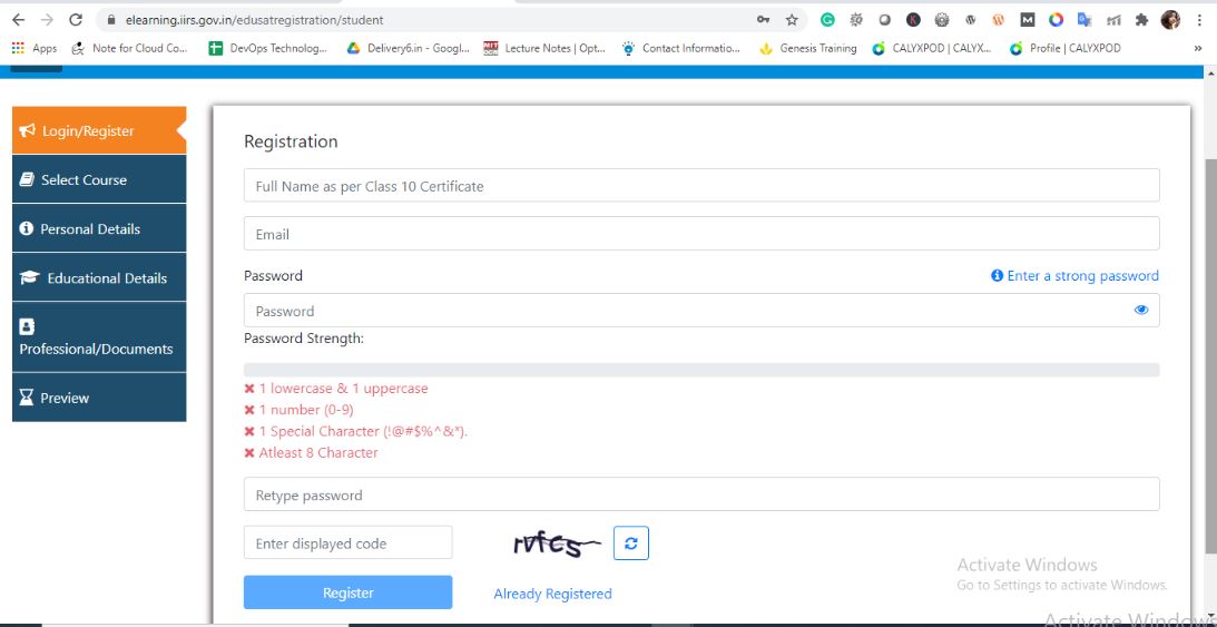
Fill the Registration form or create an account. When the registration is done you will get the account activation link on your email by which you register yourself. After activation of your IIRS account go ahead and fill the form. https://elearning.iirs.gov.in/edusatregistration/student
Dawnload Course Boucher
Award and Certificate
For getting the certificate of this course the participants must fulfill 70% of attendance and get 40% marks in the online examination of this course.
Conclusion
Hope this blog will be useful for all readers who want to register or get the certificate from ISRO. If you find this blog is useful then please comment and share.


0 Comments